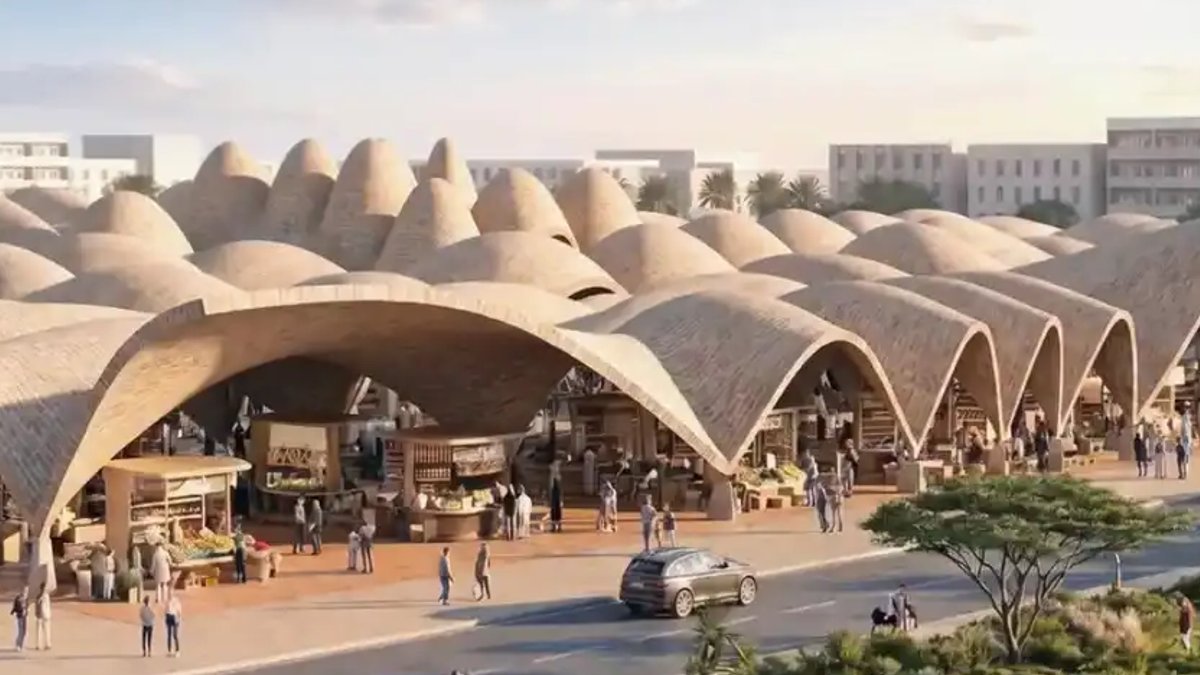
Libya’s second-largest city, Benghazi, is set to undergo a major transformation by 2050 under the Benghazi 2050 Next Generation City Plan, unveiled in September 2026. Developed by London-based ZHA in partnership with an international consortium, the initiative combines Benghazi’s historical identity with advanced digital tools to guide its rapid urban expansion. At its core lies a Digital Planning Hub, a centralized platform that merges spatial data, real-time analytics, and development projects into a single interface. This system will coordinate growth across neighborhoods, waterfront areas, and infrastructure while preserving the city’s cultural heritage.
The plan’s structure rests on two pillars: a Vision and Spatial Strategy grounded in Benghazi’s existing character, and the Digital Planning Hub itself, which functions as a dynamic database of urban conditions. The strategy prioritizes reconnecting the historic center with the Mediterranean coastline through public transport networks, pedestrian pathways, and new employment districts. Unlike conventional master plans, this framework is designed for continuous adaptation, balancing heritage preservation with controlled development.
Benghazi’s recent infrastructure investments—spanning housing, economic zones, and public services—pose risks of disjointed growth if projects lack coordination. The Digital Planning Hub mitigates this by consolidating diverse datasets, including geospatial models, population trends, transport networks, climate resilience metrics, and active development projects. This unified system enables planners, investors, and municipal authorities to evaluate proposals within the broader urban context, ensuring alignment with long-term sustainability objectives.
Green buffers and climate defenses shape Benghazi’s future
Ecological resilience is a central focus of the plan. Designated zones for natural water management and biodiversity will counteract urban density while serving as climate buffers. Given Benghazi’s coastal vulnerability to rising sea levels and extreme weather, these green spaces will play a critical role in risk mitigation. The hub’s digital twin technology will continuously update these ecological models, allowing the strategy to respond to evolving conditions.
The consortium behind the plan, comprising A&O TEC, Prior+Partners, Homa, and Buro Happold, spent years refining the proposal through computational design and master planning expertise. Their work resulted in a flexible framework that replaces static blueprints with a collaborative decision-making platform. The plan’s first public presentation occurred at the Global Competitive Urban Planning Initiative in September 2026, showcasing its integrated approach for the first time.
Read Also: Woman repurposes old CD racks for storage
Digital hub enforces alignment, cuts project silos
The Digital Planning Hub’s impact extends beyond technical analysis by promoting transparency and shared decision-making. Developers submitting proposals must align them with the hub’s scenarios, reducing the risk of isolated projects that disrupt urban cohesion. The platform also simulates future growth patterns, helping authorities preempt challenges like traffic congestion or resource shortages before they arise.
Benghazi 2050’s adaptability sets it apart from traditional master plans, which quickly become obsolete. The framework incorporates new data, such as population shifts or updated climate projections, in real time, allowing the strategy to adjust as conditions change. This flexibility is particularly vital for a city with Benghazi’s complex history, where heritage preservation must coexist with modern development needs.
Political and technical hurdles remain ahead
While political stability and sustained funding remain critical for long-term success, the hub’s technical infrastructure is already operational. Its integration of GIS mapping, 3D urban models, and resilience analytics provides unprecedented precision for a city undergoing rapid transformation. The next challenge is ensuring all stakeholders, from local governments to private developers, adopt the platform as a standard planning tool.
A Framework Rooted in Collective Memory
The Vision and Spatial Strategy for Benghazi 2050 prioritizes the city’s historical layers and public memory, ensuring development respects its cultural identity. Unlike many urban plans that emphasize economic or technical goals, this strategy begins with an in-depth analysis of Benghazi’s existing character, its historic districts, community patterns, and residents’ emotional connections to landmarks. Key intersections between past and future, such as the historic center and waterfront, will be reconnected through pedestrian corridors and public spaces, reinforcing Benghazi’s identity as a Mediterranean port city. The plan mitigates risks of displacement or cultural erasure by embedding preservation measures into its spatial design. Heritage corridors will guide new construction while protecting landmarks from encroachment, contrasting with past development cycles in Libya where rapid modernization often destroyed historic fabric. By treating collective memory as a planning tool, the strategy ensures Benghazi’s transformation reflects, not replaces, its heritage.
Stakeholder engagement is equally essential. The hub’s shared interface will host public workshops where communities can input local knowledge, such as flood-prone areas or informal markets, into the digital model. This participatory approach aims to democratize urban planning, ensuring decisions reflect grassroots priorities. Early adopters, including the Benghazi Municipality and private investors, have expressed willingness to integrate the hub, though broader adoption depends on political commitment and technical capacity. The first pilot results are anticipated by mid-2027, with full deployment contingent on these outcomes.





Leave a Reply